Broad, flat hollows with no ready-made explanation: on Mount Sharp, the cameras of NASA's Curiosity rover photographed pits in August 2026 that are "unlike quite anything we have seen in the past," writes Michelle Minitti, deputy principal investigator for MAHLI, the rover's close-up camera. Here is what these one-centimeter cavities can tell us about the Martian bedrock.
In 14 years on Mars, Curiosity has never seen this
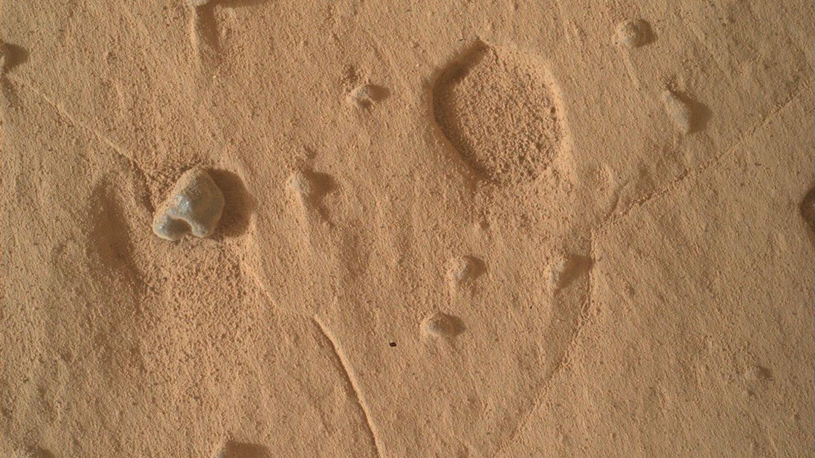
From Sol 4,988 to Sol 4,994, the Martian day of 24 hours and 40 minutes, the rover crossed two workspaces, the flat areas where it parks to study rocks up close. On both of them, the bedrock, the rock that has stayed in place for billions of years, turned out to be dotted with broad, shallow pits. "Both of our workspaces this week contained features unlike quite anything we have seen in the past," reports Michelle Minitti in the mission log NASA published on Sept. 3, 2026.
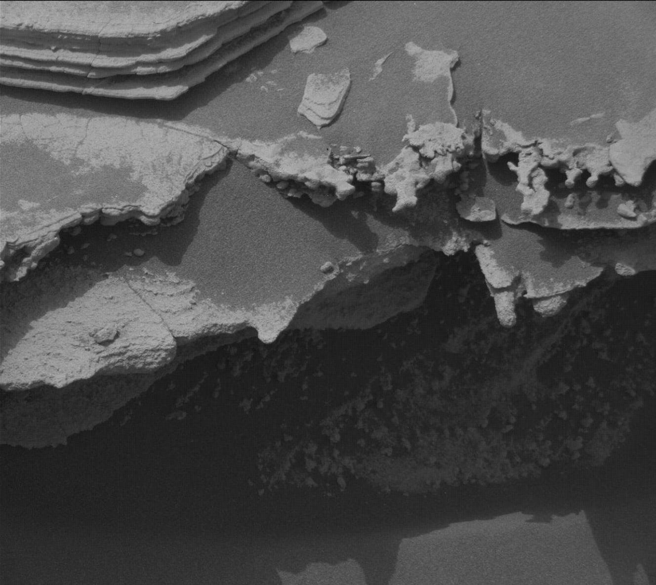
The most photogenic of the lot fits in a centimeter. The pit MAHLI captured on Aug. 19, 2026, during Sol 4,989, draws an almost perfectly circular hollow in the rock. In the image, these cavities look like footprints pressed into the Red Planet. The scientists see something else: a fresh erosion puzzle to crack, fourteen years, almost to the day, after the rover reached Gale Crater on Aug. 6, 2012.
Cavities that break the usual recipe
Pits are not rare on Mars. The textbook scenario: when a nodule, a small hard pebble embedded in the rock, resists erosion better than its host, it eventually works loose and leaves a hollow behind. Think of the hazelnuts in a chocolate bar popping out and leaving their little cups.
This week's pits upend that recipe in two ways. First the shape: they are much broader and much shallower than any hollows seen before. Then the setting: "the pits of this week were much broader and shallower than past features and were not accompanied by obvious objects that were once in the pits," Minitti notes. In other words, the cup is there, the hazelnut is nowhere to be found. Did another process carve these cavities? The question stays open, and that is exactly what delights the team: a brand-new problem to chew on, in rocks they have been studying for years.
Four instruments to map the pits in 3D
To chase down these pits, the team called on the rover's geology kit. MAHLI, the Mars Hand Lens Imager, a magnifying-lens camera at the end of the robotic arm, took the closest shots. Its trick: photograph the same target at several focus distances, then stack the images into a single photo sharp from edge to edge.
The stereo mosaics, two images of the same spot taken from slightly different angles, like our two eyes, carry the signature of MAHLI and Mastcam, the pair of color cameras on the rover's head. From those pairs, the team can compute a digital elevation model, a relief map of the kind a hiking map shows, that returns the exact depth of every pit.
ChemCam, the instrument that pairs a laser with a telescope, added the long-distance view: it vaporizes pinpoint spots of material, and a spectrometer, which reads the emitted light to identify chemical elements, decodes the signal. At the other end of the arm, APXS, the Alpha Particle X-Ray Spectrometer, a sensor that bombards the rock with alpha particles, helium nuclei, and X-rays, read the makeup of the gray layers within centimeters. Four sets of eyes, one goal: understanding what carved these hollows.
A chemistry that does not match the bedrock
The week delivered a second clue, a deeper one. MAHLI, ChemCam and APXS analyzed gray, rough, resistant layers that differ from the surrounding bedrock, likely with "a different chemistry," the mission blog sums up. Those materials, visible right inside the hollows, open an unexpected window on the history of this slice of Mount Sharp.
Mastcam and ChemCam also mapped complex packages of layers, where texture and structure change over a few centimeters of height. Those quick switches look like changes in deposition conditions, in other words different episodes of sediment piling up, recorded side by side. ChemCam also zapped one of the gray float rocks, pebbles torn from their parent rock and scattered across the workspaces, to retrace their story. The full mosaic of the Cordillera butte and the images of the Tolhuaca and Potosí buttes, farther south down Valle Grande, round out the investigation, hunting for crossbedding, tilted layers that preserve the record of ancient currents of water or wind, and the dark material capping Potosí.
A dust storm in the background
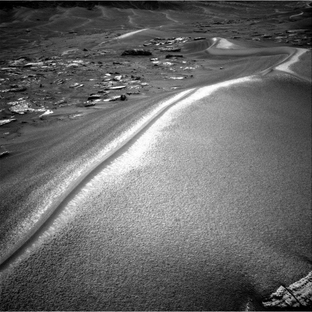
The whole hunt played out under a closely watched sky. The environmental team scheduled REMS, the rover's weather station, along with Mastcam and Navcam, the navigation camera, at a higher-than-usual cadence to track a regional dust storm. The threat dissipated by the end of the week, the mission log notes.
The rover did not work at full speed, though: one planning day was lost when the radio link that returns data to Earth failed to show up. No matter, Curiosity kept observing. On Aug. 26, 2026, it marked one kilometer of elevation gained since arriving at Gale Crater, and it keeps climbing the slopes of Mount Sharp, still reading the Red Planet's history one layer at a time.
Going further
- The mission page of Curiosity, on duty in Gale Crater since August 2012.
- Key notions: Mars and rover in our glossary.
- To explore the sky from home: the interactive sky map, the stargazing guide and the astrophotography gallery.
- The official sources of this article: NASA's Curiosity mission blog, Sols 4988-4994 and the Mars Science Laboratory mission overview.