On the night of 14 to 15 September 2026, a Vega-C rocket lifted off from Europe's Spaceport in Kourou, French Guiana. It carried two satellites built for very different jobs. One will measure a glow nobody has ever seen from orbit, the light that plants give off while they photosynthesise. The other takes over the continuous monitoring of the entire planet. Together they show how Europe keeps a close watch on a changing climate.
A night launch, two satellites delivered an hour apart
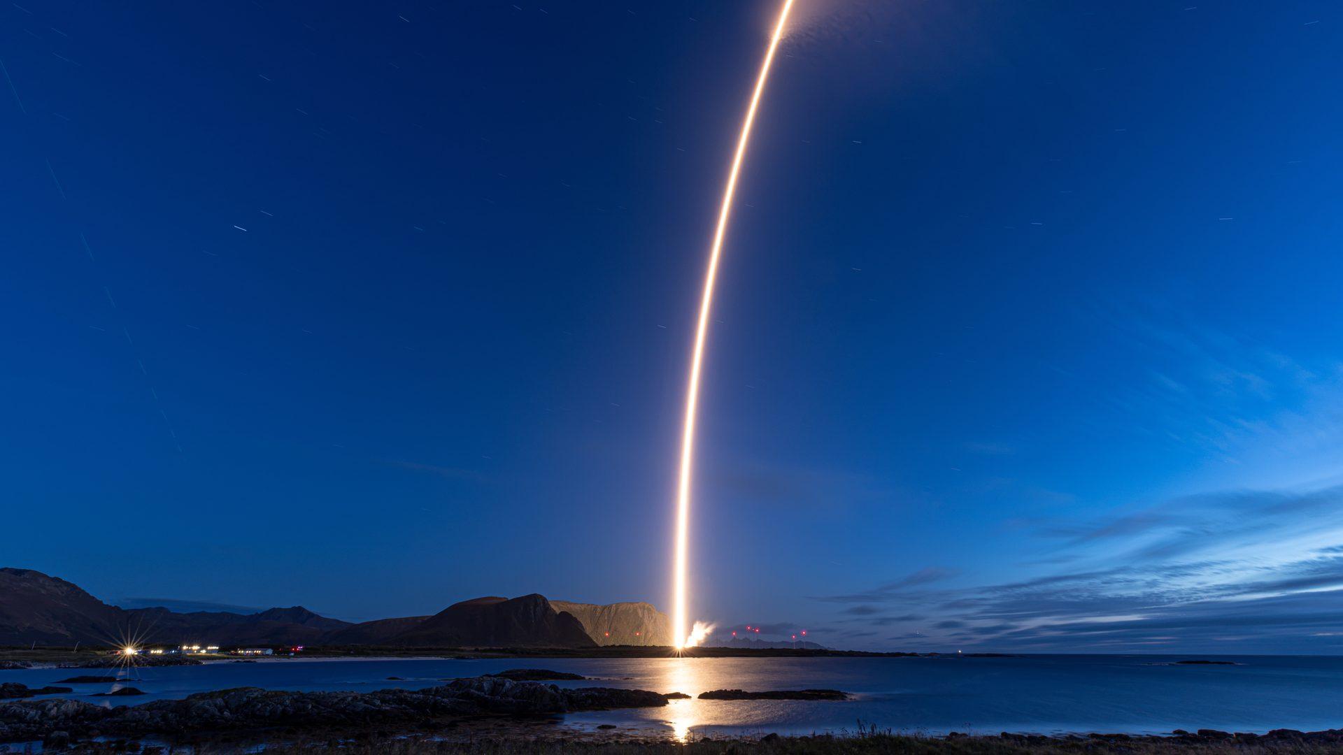
The countdown stopped at 03:21 CEST, which was 22:21 the previous evening in Kourou and 01:21 Universal Time. The rocket left its pad heading over the Atlantic, on a path that crosses water instead of populated land.
The flight is designated VV30. It is the eighth launch of Vega-C, the upgraded version of Europe's light launcher, and the second one operated by the Italian company Avio itself. A sign that this is no routine mission: ESA calls it the rocket's first dual launch.
Why two at once? Because both satellites rode together, stacked inside the fairing, the nose cone that protects them during the climb through the atmosphere. Sentinel-3C sat at the top. FLEX was installed lower down inside an adapter called Vespa, an intermediate structure that both holds it and houses it. That arrangement sets the release order. Sentinel-3C was deployed first, at 04:21. Then Vespa opened to let FLEX go, at 05:17, one hour later. From liftoff to the release of the last satellite, the flight lasted 116 minutes.
That first signal is not a paperwork detail. Until a satellite has spoken to an antenna on the ground, nobody knows whether it survived the shaking of liftoff and the violent opening of the fairing. Both answered. Teams have now entered commissioning, several days of checking every system before the science instruments are fully switched on.
VV30 by the numbers
- Two satellites: FLEX at 397 kg, and Copernicus Sentinel-3C at 1,143 kg.
- One rocket: Vega-C, 35 m tall, 210 tonnes on the pad, able to carry 2,300 kg to a sun-synchronous orbit.
- One destination: a sun-synchronous orbit at around 820 km, tilted 98.6° to the equator.
- One flight: 116 minutes from liftoff to the release of the last satellite.
FLEX and the invisible glow of a struggling plant
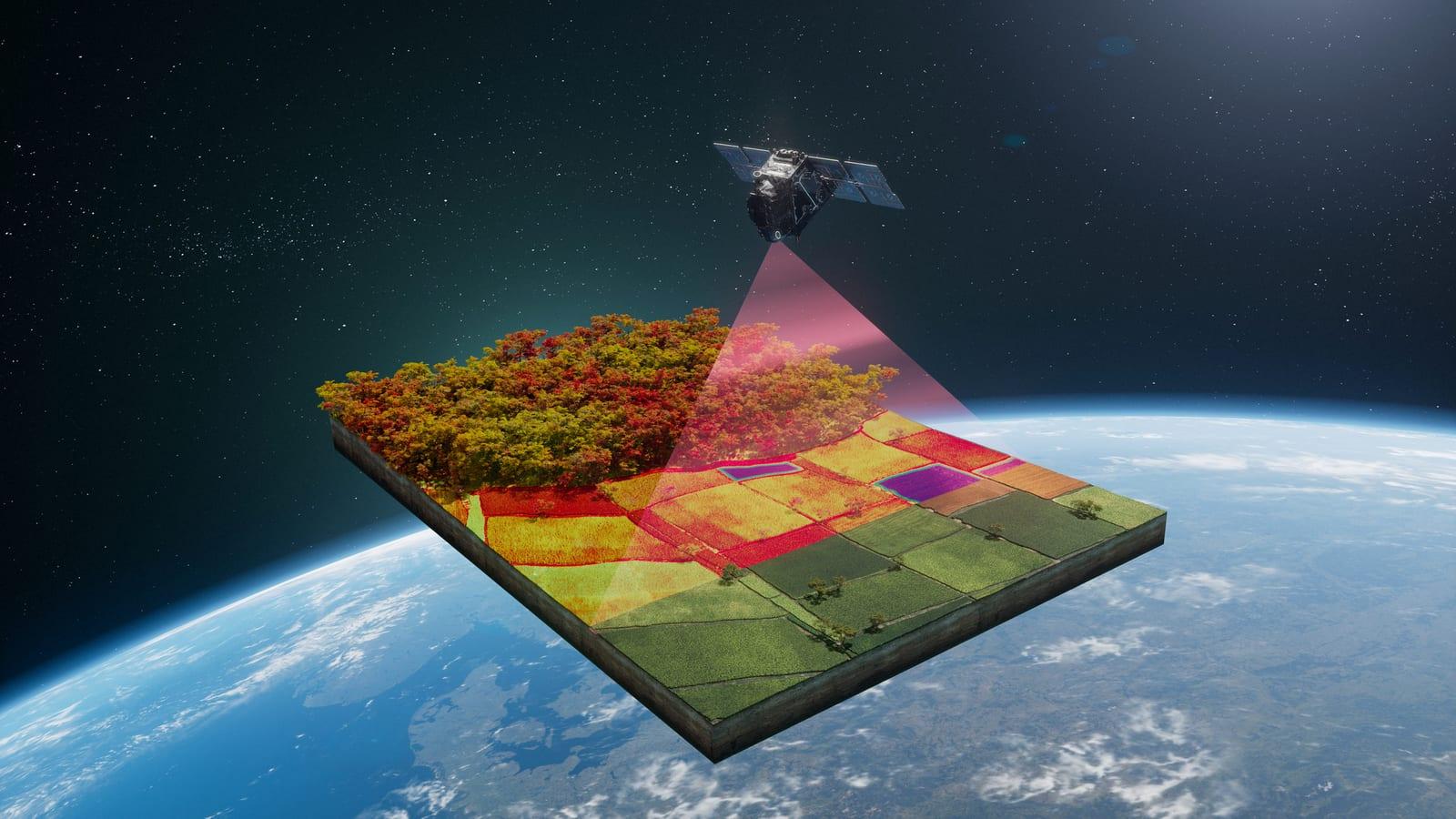
This is the strangest experiment on board. Take a green leaf in sunlight. It reflects light, which is why you can see it. It also emits another kind of light, a faint glow that has nothing to do with reflection.
The explanation fits in one sentence. Chlorophyll, the molecule that gives plants their colour and captures sunlight, does not use all the energy it absorbs. A small share comes back out as red and near-infrared light. That overflow is called fluorescence, and its strength is tied directly to photosynthesis, the process that turns light and carbon dioxide into plant matter.
A simple way to picture it: think of an energy leak. A healthy plant pushes most of the captured light into photosynthesis, so the leak stays small. A plant under drought, missing nutrients or attacked by pests redistributes that energy differently, and its glow changes.
Do not picture a Christmas tree. This fluorescence is invisible to the human eye, and it needs sunlight. A leaf in the dark does not shine, unlike a firefly, which produces its own light.
FLEX is the first satellite designed to hunt that signal from orbit. Its main instrument, the Fluorescence Imaging Spectrometer FLORIS, was built by Italy's Leonardo. It splits incoming light by wavelength, the way a prism spreads out a rainbow, then looks inside that spread for the two peaks that mark plant fluorescence, near 685 and 740 nanometres. Two shades of red that the eye cannot even tell apart.
The output will be global maps divided into squares 300 metres across. At that resolution you cannot see leaves, but you can tell farmland from forest and grassland, and above all you can watch how they change over time.
One detail is worth keeping in mind, because it separates the reality from the shortcut version. When a plant struggles, its fluorescence does not always drop. Depending on how far the stress has gone, the signal can rise or fall. Fluorescence alone does not say "this plant is in trouble". It says "something has changed, and here is when". Only by combining it with other measurements can scientists work out what is actually happening.
Sentinel-3C, the next chapter of a ten-year record
The second passenger comes from a different school. Sentinel-3A and Sentinel-3B, launched in 2016 and 2018, already deliver daily measurements of the oceans, land, ice and atmosphere. Sentinel-3C is the third of the series, and its first job is to make sure that record does not break.
That continuity matters more than it sounds. A single satellite produces images. A series of identical satellites spread over decades produces trends. That is the difference between taking your temperature once and knowing whether a fever is rising.
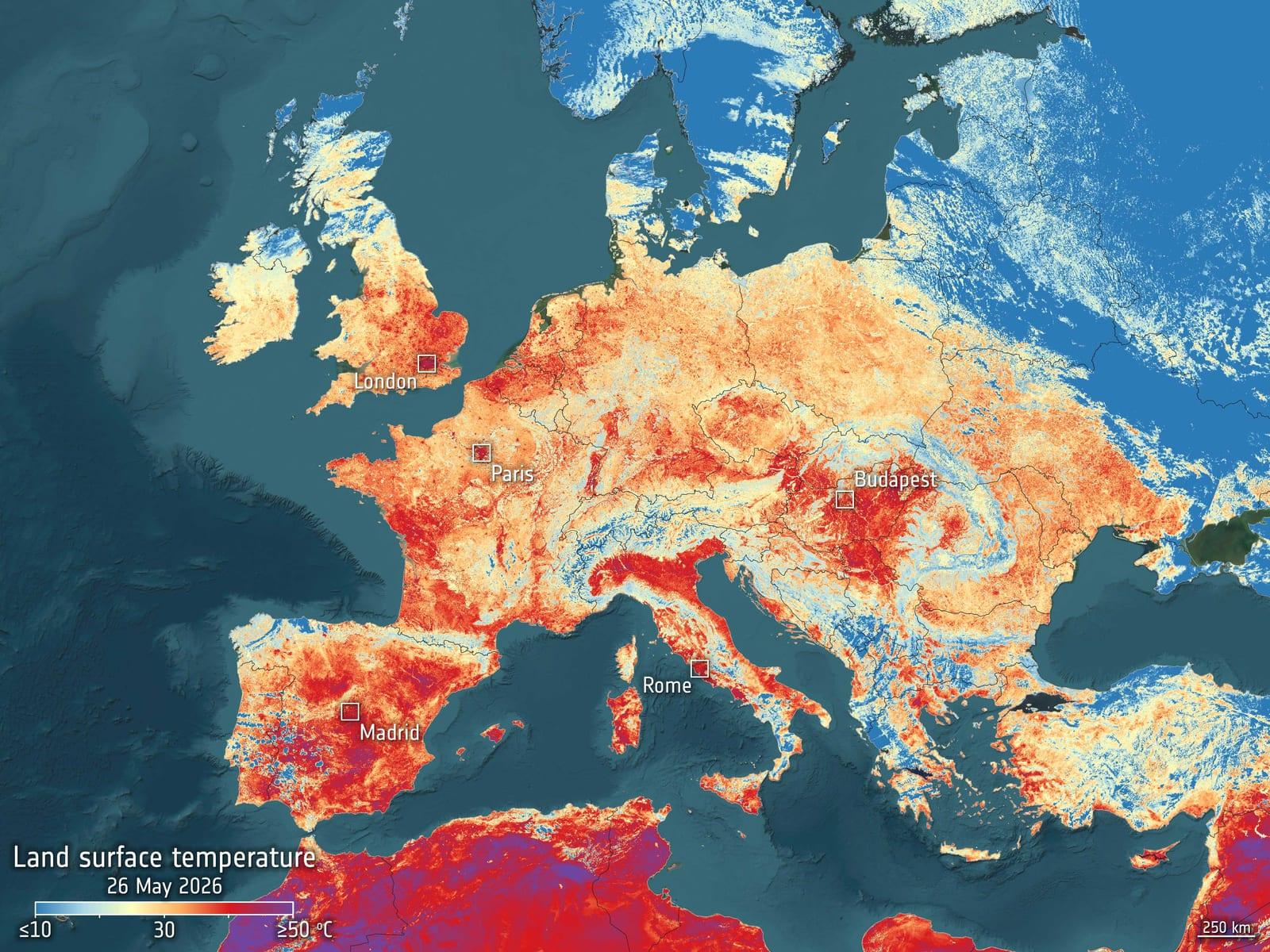
Sentinel-3 covers a lot of ground, and four instruments share the work. The flagship one measures the surface temperature of oceans and land to better than 0.3 kelvin. A kelvin is the physicist's unit of temperature, graded like the Celsius degree but counted from absolute zero. The margin is so tight that this instrument serves as a reference for tracking warming. Another instrument dissects the colour of water and vegetation across 21 bands of light. A third, a radar altimeter, measures the height of seas, lakes and rivers by timing how long a radar echo takes to bounce back.
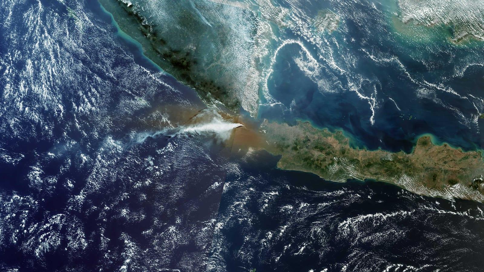
The figures that come out of these measurements feed into IPCC reports and into 55 Essential Climate Variables defined by the Global Climate Observing System, the international reference for what is worth measuring. Global sea level, for instance, has been rising by 3.64 mm per year since 1999, and the pace is accelerating. Sentinel-3 can also spot methane leaks of at least 10 tonnes per hour, a powerful greenhouse gas, and keep an eye on wildfires, heatwaves, Arctic ice and smoke plumes that drift across borders.
This launch does more than extend the series. It secures it for years to come, with a fresh satellite just as its two older siblings age. The mission is then run jointly by ESA and Eumetsat, Europe's organisation for meteorological satellite operations, on behalf of the European Commission.
Why these two spacecraft are a pair built to read the climate
Here is the most interesting part of the mission, and the reason both satellites flew on the same rocket.
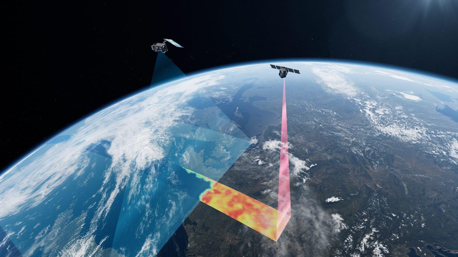
FLEX will not fly alone. It will follow a Sentinel-3 satellite a few minutes behind, in a tight formation known as flying in tandem. The same patch of ground is therefore observed almost simultaneously by two different instruments. FLEX measures the glow of the plants. Its companion reports on the atmosphere above them, including clouds, aerosols and water vapour, plus surface temperature and the type of vegetation.
Combining the two datasets removes the ambiguity. Fluorescence on its own tells you something is happening. Paired with the atmospheric context, it tells you where, when and probably why. ESA sums up the goal as a view of global vegetation function and status unlike anything before.
Why aim for a sun-synchronous orbit at around 820 km? Because satellites there cross each region at the same solar time on every pass. Images taken ten years apart stay comparable, like photographs always shot under the same lighting. That is the foundation of any long-term environmental monitoring, and the reason most Earth-observation satellites sit in this orbit.
What the mission delivers, in one line, is the ability to follow the health of the planet's vegetation almost in real time. Photosynthesis links carbon in the atmosphere, the water cycle and food production. Knowing where forests or crops falter before they turn yellow opens the door to better climate models, farming that uses less water and fertiliser, and biodiversity tracking that no longer depends on people walking the ground.
ESA notes that FLEX belongs to its FutureEO programme, the family of exploratory missions that tests unproven ideas. It is the eighth of them. Since the first satellite in that family, the logic has not changed: invent an instrument that can see what nobody was measuring, then put it above our heads.
Going further
- Explore the planet from orbit with our tools: live Earth state and our light pollution map.
- The definitions that help you follow this mission: the atmosphere, Earth orbit and ESA.
- Two other watchful eyes to compare: the International Space Station, which observes Earth from 400 km up, and Gaia, whose star catalogues also support precision positioning.
- The launch video: ESA on YouTube.
- The sources for this article: ESA's launch release, the FLEX mission page, the Sentinel-3 mission page, the Sentinel-3 climate feature, Avio's release and Thales Alenia Space's release.
- Your best shots of Earth and sky: share them in our astrophotography gallery.